Sur Lipez Tour
 |
| Thermal springs pool |
 After reading about all the horror stories of peoples misadventure on
this three day tour across southern Bolivia I was somewhat apprehensive
about picking a tour company. In the end I asked a few questions at my
hostel and took their word (which matched my information to some degree)
and went to talk to the tour agents themselves, which even with my
limited Spanish was not so bad. All seemed ok, so I booked with one.
After reading about all the horror stories of peoples misadventure on
this three day tour across southern Bolivia I was somewhat apprehensive
about picking a tour company. In the end I asked a few questions at my
hostel and took their word (which matched my information to some degree)
and went to talk to the tour agents themselves, which even with my
limited Spanish was not so bad. All seemed ok, so I booked with one.Two days of driving across several deserts and mountain ranges (including the Cordelera de Lipez, which in part explains the tour name) and we arrived in the town of Uyuni on the edge of the Salir de Uyuni. Our tour group agrees to get up at 5:00am in order to be on the salt flats in time for the sunrise. At 7:am the sun is up and our driver has still not arrived. When he does finally show he is drunk. After sending him away we manage to contact the tour company who (to their credit) does set things right and by 9:00am we are on our way, but no sunrise photos! :(
 |
| Bolivia border control |

 This elevation is too high and the climate too dry to support much in
the way of vegetation, so the landscape is somewhat reminiscent of old
science fiction movies of the surface of Mars. The mountain ranges are
both sandstone and volcanic and the desert plains between them match.
(In places there is actually a visible line stretching across the plain
where the sand and rock on one side is sandstone and the other
volcanic.)
  |
| The famous Rock Tree (or in this photo Loco Pollo) |
 The sandstone deserts come complete with gullies,
outcroppings and areas of boulders that have been eroded by wind into
fantastically shapes.
The mountains look like huge piles of
multi-coloured gravel, some of which are high enough to be still be
covered in snow in the middle of summer. The volcanic ranges have peak
after peak of the typically conical volcano, many of which have blown
their tops off millennia ago, but almost all are high enough to have
snow-capped peaks.
 |
| Blue Lagoon |
 At first it isn't overly apparent you are passing through mountain ranges as all
of the mountains are quite widely separated with broad sandy, rocky or
rock strewn plains between them. The lagoons are also vary varied, most
being very shallow and some supporting life while others are totally
dead, and hence the wide variety in their colours for which they are named (white, red, blue,
green, stinky...). All but the dead lagoons had a good variety of bird
life, the most obvious being the flamingos, which were present by the
thousands.
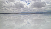
 The Salar de Uyuni is the largest salt flat in the world and you
truly do see only a salt desert all the way to the horizon. It is
deceiving however, as it is really a lake with all its water saturated
in the salt. The water can be seen in the many small deep holes that are
scattered all over the plain which are just big enough to reach your
arm down into (and not find a bottom). You can break off some of the
salt inside these holes however, and get perfectly square or rectangular
crystals a centimeter or more in size.
 At the the edge of the Salar,
the locals mine the salt by shoveling the top five or so centimeters of
salt into piles to drain off most of the water, then load it into
ancient trucks and take it back to salt yards in town where it dries
further.
 The rainy season is just ending, and there is still a lot of water on
the surface causing a mirror effect that goes to the horizon and makes
it difficult at times to actually perceive the horizon. (Sunrise would
have been spectacular!). Several years ago a hotel was built entirely of
salt out on the flats, and operated for five years before it was
realized their waste was poisoning the environment. It now operates as a
restaurant, museum and gift shop, but with all the dirty white salt
around, it had a way of feeling like a very displaced ski hut.
 |
| Salt Hotel |
Uyuni exists for the salt 'mines' and a place to stay for tourists going to the Salar. At the edge of town however is a very interesting graveyard. The old steam trains that transported silver out of the hills have been left here on a couple of sections of track, perhaps a kilometer in length. Some of their parts have been salvaged, but for the most part, the shells are more or less intact.
 |
| Train graveyard |
 |
| The 3 day tour is marked as the yellow, green and violet lines |
--Section; 542.5km -Trip total; 24470km
friday, march 1, 2013
Sucre


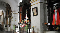
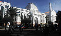 Sucre is very much what it is billed as - a clean, pretty, colonial
city. The sidewalks are in good condition, the roads are paved and there
is a significant amount of appealing architecture surviving from the
early colonial days. I am always amazed to note that some of these
buildings date back to the mid 1500's and are nearly 500 years old. Most
of the buildings are white (at least on the street side) which adds to
the whole cleanliness aspect. In fact, this is the cleanest town I have
been in yet, with very little litter visible and in the morning the
people can be seen sweeping and washing the sidewalks and gutters in
front of their shops and residences. The parks and plazas are not just concrete, grass and dirt like other places; here they have lots of sculptured gardens (and almost no dirt) and are all perfectly maintained. The potted plants hanging in the street are watered. The cemetery is kept picture perfect.
Walking around town today I once again noticed that shops of similar nature seem to always be in close proximity, if not next door to each other, and in this case it was funeral parlors. I suppose it makes it easier to shop around, but in this case I was somewhat amused thinking of things like why the street wasn't named Calle Muerte, until a moment later when I realized the hospital was across the street. It wasn't really amusing after that.
 As with many towns I've been in lately,
walking is always an exercise in awareness. Most streets are one-way,
but occasionally a two-way pops up with no center line, and often the
sidewalk peters out or because a building was built a bit deeper than
the others there is hardly any sidewalk in front of it, or when there
are traffic lights, often you cant see them because you are walking the
opposite direction to traffic.
Pedestrians do not have the right of way and many times I've been rather startled when I'm in the middle of the intersection and a car decides to turn the corner right in front of me, and of course they are very adverse to braking for pedestrians, preferring instead to just honk their horn. Having grown up with the car horn being used mostly for near emergencies, it is difficult to get used to the idea of it being used for conversations...like, "Hey there, I'm coming up behind you", "I'm not slowing down so you had better speed up", "Hi everyone, I'm coming through the intersection!", and of course, "Whats going on up there?".
 |
| Central Park |
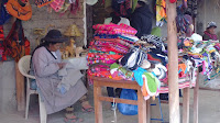
 All towns have a food market hidden away somewhere and I always love finding them, because this is where you get the freshest fruit, vegetables, meat, fish or even flowers and often there are treats like fruit smoothies available. I am always amazed at the quantities of food available in these markets, but I suppose the vendors wouldn't bring it in if it couldn't be sold.
On a side note, one of the cheapest drinks available (cheaper than pop
anyway) is fresh squeezed fruit juice from one of the street vendors. In
the market you get a good taste for the traditional, and in the case of
Bolivia, traditional is multi-layered, bright coloured clothing and bowler hats. I notice that in Sucre however, only a small minority of the people seem to be wearing hats of any kind.
 |
| Child Artisans |

On a weekday evening after work, the people that aren't out in the parks are out in the streets shopping for dinner or sundries or clothes or maybe just an ice cream cone. On a nice Saturday afternoon they are out in the parks with their kids where there are all kinds of activities available like painting pictures, train rides, peddle cars, pony rides and for the bigger kids, quad rentals, and of course there are always the food vendors.
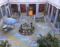 |
| Courtyard of the $10 hotel I stayed at in Sucre |
I think if I was to spend an extended time in any place, this would be at the top of my list, not only because you can get a Chinese food meal for $3 and 1/2 kilo of mozzarella for $4, but there is something very appealing about the town. Perhaps it is the palm trees.... The people at first seem to be very distant, but in reality are very nice and even occasionally try to talk to me, which unfortunately due to my limited vocabulary usually doesn't get far. (I guess I'll have to work on that one for next time!)
--Section; 380km -Trip total; 24850km
monday, march 4, 2013
La Paz
 |
| those are sports courts along the roadway |
 |
| I call this 'Golden Street' |
 This is just a lay-over as my bus from Sucre arrived at 9:00am and
the bus to Cuzco leaves at 8:30am, so I used the day to have a walk
around. I also had to visit someone in the Witches Market.
 |
| yes those are dried llama fetices (they actually look a little like miniature dragons) |
The other thing that struck me was the amount of pavement, although I did manage to find a couple of plazas and there is the little bit of vegetation along the center of El Prado, the main road through the center of town. Street vendors and market stalls are significantly more evident here than in Sucre as well.
 |
| Iglesia San Francisco |
 |
| Iglesia San Francisco |
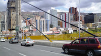 And of course there is the whole altitude and walking uphill thing. It is a bit of a catch-22 , in that if I breath deeply, I find I can get enough oxygen to keep a good pace, but the problem is the vehicles
belching all their smelly exhaust which makes it really hard to breath
deeply. (I am so going to enjoy the clean air when I get home!)
And of course there is the whole altitude and walking uphill thing. It is a bit of a catch-22 , in that if I breath deeply, I find I can get enough oxygen to keep a good pace, but the problem is the vehicles
belching all their smelly exhaust which makes it really hard to breath
deeply. (I am so going to enjoy the clean air when I get home!)--Section; 697km -Trip total; 25547km


